Acrylic Facility Maps
Visual safety guidance for simplified facility navigation and emergency response. Our acrylic facility maps blend seamless functionality with professional implementation. This mapping system ensures that accurate, life-saving information is available at all times.
Features and Benefits
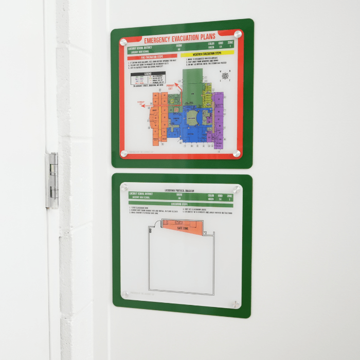
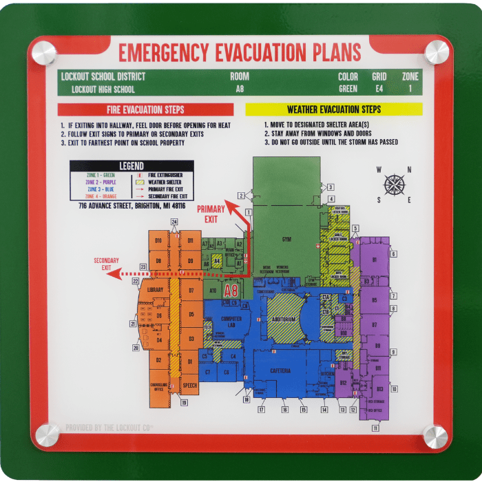
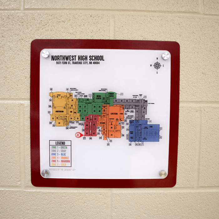
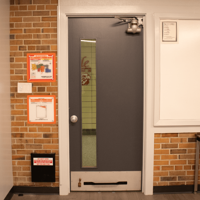
Color-coded zones for instant area recognition & strategic placement for maximum visibility
Digital maps available for staff and local police dispatch
Premium acrylic construction for lasting durability
Highly detailed facility floor plans
Integration with The SmartBoot System® and Rapid Response Placards
Multiple map types for comprehensive coverage
Building-Wide Safety Integration
Each map type serves a specific purpose in your facility’s safety infrastructure:
Safety Zone Diagrams
Room-specific information, including room layout, identification numbers, safe areas, and emergency equipment locations.
“You Are Here” Maps
Full building map with a current position icon marking each exit.
Emergency Evacuation Plans
Full building map with room-specific exit routes, severe weather shelter areas, and emergency equipment placement.
How Acrylic Facility Maps Work
The process begins with a thorough facility assessment, where our team maps your entire building to generate an up-to-date floor plan map.
We then create custom maps that match your facility’s specific needs, incorporating safety zones, evacuation routes, exits, and emergency equipment locations. Once the maps are finalized, we print them in-house using a large format flatbed printer. Our installation team securely mounts each map, positioning them at strategic points around the building for maximum visibility.
To support proper use, we provide comprehensive staff and student training so everyone understands how to interpret the maps and follow emergency protocols.
Why Acrylic Facility Maps Are Crucial
In an emergency, every second matters. When first responders arrive at your facility, they need immediate access to critical information including building layout, available entrances, safety zones, and equipment locations.
Traditional paper maps fade and become misplaced over time. Our acrylic facility maps solve these challenges with durable, reliable, clear, and instantly accessible visual guidance.
The LockOut team developed these maps with input from emergency responders and facility managers, resulting in highly detailed maps that eliminate confusion, decrease response times, and save lives.
Our mapping solutions are valuable tools for daily navigation and crisis response. As an essential component of any facility safety plan, these maps provide the visual information needed for swift, coordinated emergency response while protecting your people every day.
Use Cases
Schools
- Classroom-specific evacuation routes
- Simple emergency response protocols
- Entry point identification
- Safe zone identification
- SmartBoot System® component locations
Healthcare Facilities
- Department navigation
- Emergency equipment locations
- Patient evacuation routes
Corporate Buildings
- Floor plan navigation
- Emergency exit paths
- Safety equipment placement
- Visitor orientation
Integration with SmartBoot® System
- Matches Color-Coded Zoning System
- Shows SmartBoot System® component locations
- Supports emergency response protocols
- Enhances overall facility security
- Accessible by law enforcement via Smart Tablets
Client Testimonial
“I truly believe that The Lockdown Company’s product is an extremely important layer of security for our teachers in their classrooms.”
– Sheriff Tom Reich, Eaton County Sheriff’s Office
Technical Specifications
Premium-grade acrylic
1/8inch
11.5” x 11.5”
Securely affixed to the wall
Full color UV printed images with facility-specific details
Optional 13.25” x 13.25” powder coated backplate to match zone color
Request More Information
- Schedule a facility assessment
- Discuss custom solutions
- Provide detailed installation specifications
- Get a detailed quote